What You'll Find in This Post
Quick Facts About Monte Brè
- Location: Lugano, Ticino, Switzerland
- Transport: Hike or funicular from Cassarate or Suvigliana stations
- Cost: CHF 26 round-trip funicular (free with Swiss Travel Pass)
- Duration: 1.5-5hr hikes; 10-14 minute funicular ride each way
- Activities: Hiking, mountain biking, panoramic eateries
Tip: Sit in front on the funicular for best views!
Disclaimer: This post contains affiliate links. If you book or buy through these links, I may earn a small commission at no extra cost to you. Thank you for supporting my blog!
Switzerland's Sunniest Mountain
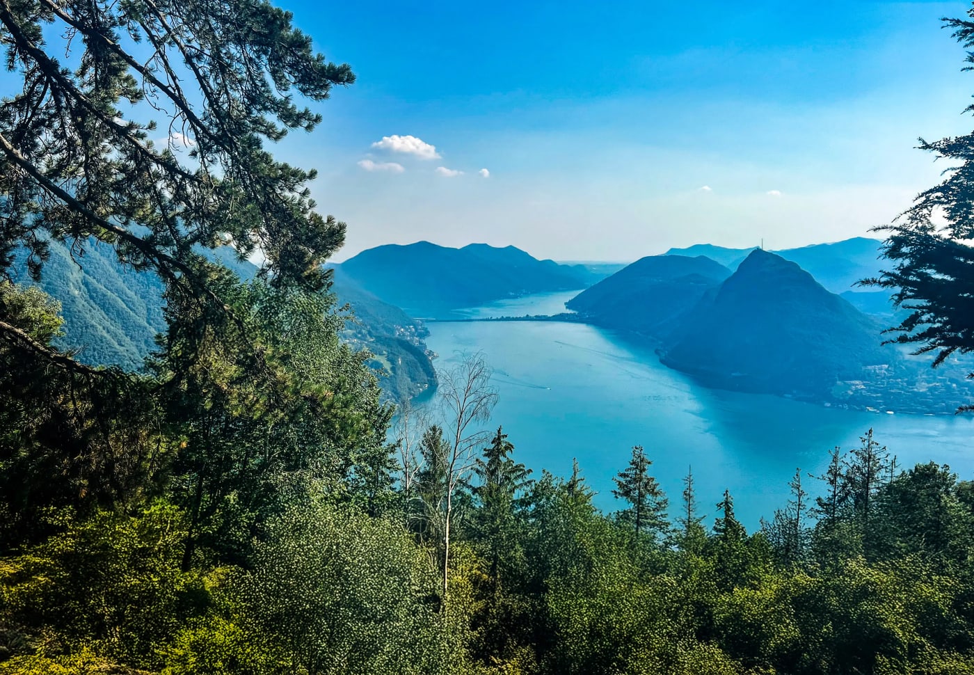
Rising to 925 meters above Lake Lugano, Monte Brè claims the title of Switzerland’s sunniest mountain—a reputation earned through its geography and climate. Located in Switzerland’s southernmost region of Ticino, its south-facing slopes are sheltered from cold northern winds while receiving more sunlight than many other Swiss mountains. The result is a Mediterranean microclimate which supports palm trees, cypresses and olive trees. Even rare Christmas roses bloom here, defying alpine norms, which is something special to see in Switzerland - visit in winter for a rare bloom sighting! It's accessible via hiking trail or a historic 1912 funicular which will have you at the peak in 10-14 minutes. It's Luganos underrated gem with panoramic views of blue waters, mountains, and terraced vineyards, making it a must for those exploring the Ticino region!
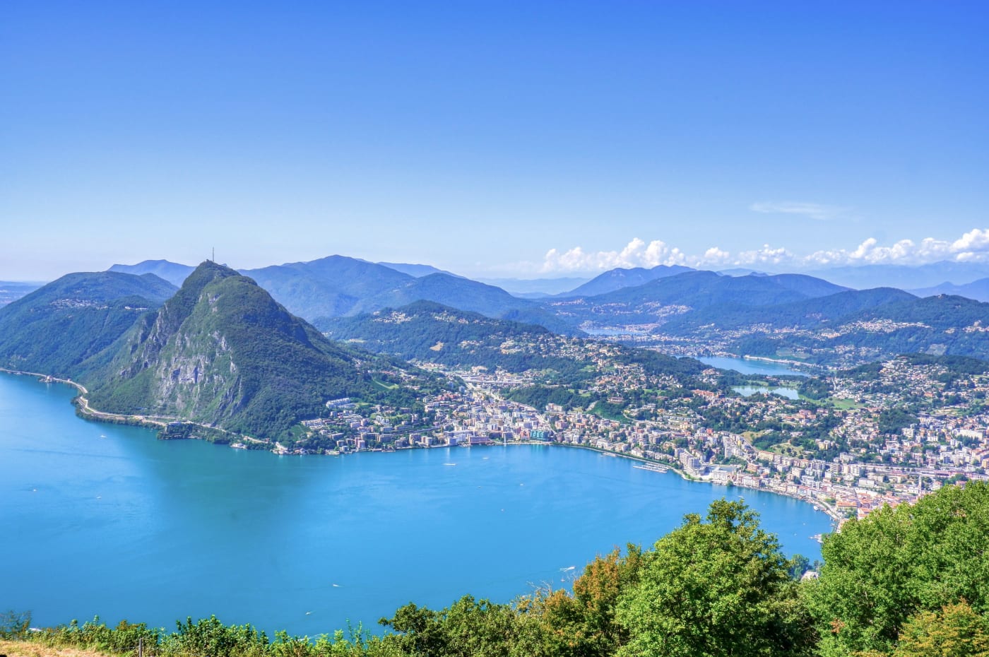
Views from Monte Brè's peak (Photo by Antonio Sessa on Unsplash)
Monte Brè Funicular
Stations, Access, and Details
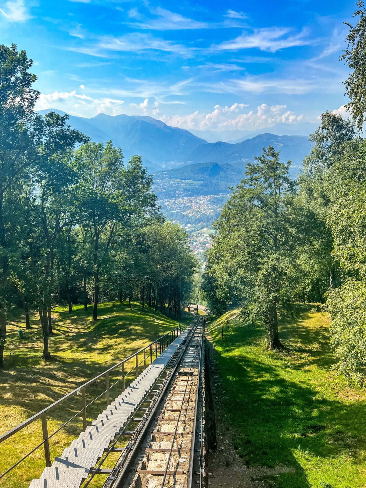
While rewarding, the full hike up can be strenuous (1.5-2.5 hours); opt for the funicular up and hike/bike down for the best of both worlds. It's just as scenic and much easier, plus, the funicular system is really something special. Opened in 1912, the Monte Brè funicular is one of Switzerland’s oldest and most charming mountain railways designed to open the slopes of Monte Brè to tourism and connect the scattered hillside villages above Lugano.
It's split into two independent sections - extremely rare in Europe - with the main entry points for visitors starting at Cassarate (lowest section) and Suvigliana (upper section). You typically start at Cassarate, take Section 1 to Suvigliana, then cross the street to board Section 2 for the summit. After Suvigliana there are 3 stops before reaching the top station, but these are mostly only used by local villagers living higher above lake Lugano. As a tourist you're more likely to get on in Cassarate or Suvigliana.
Route Breakdown
Section 1 (Lower Section)
- Cassarate (Via Pico 8, 6900 Lugano) → Suvigliana (Via Ceresio di Suvigliana 36, 6977 Ruvigliana)
- A quick, urban connector
- Length: ~196m
- Duration: ~4 minutes
Section 2 (Upper Section)
- Suvigliana → Albonago → Aldesago → Brè Villaggio → Monte Brè Summit
- Winding and scenic through forests and villages
- Length: ~1,403m
- Duration: ~10 minutes
How to Get There
To get to Cassarate Station from Lugano center (e.g. Parco Ciani), it's a quick 20-25 minute walk via the lakeside path (Lungolago) toward the Lido di Lugano beach area, then follow signs to "Monte Brè Funicolare." It's flat and easy. Alternatively you can take bus line 2 from "Lugano, Centro" or "Lugano, Palazzo Civico" stops to "Cassarate, Monte Brè" stop (operated by Trasporti Pubblici Luganesi/TPL; 5-7 min; ~CHF 2.50).
For Suvigliana Station, take bus line 5 or 5/6 from "Lugano, Centro" stop to "Ruvigliana, Centro" or "Ruvigliana, Suvigliana" stop (TPL busses; 10-15 min; ~CHF 2.50). From there it's a short 5-min walk uphill to the station.
After hiking the lakeside Olive Grove Trail, we walked to Castagnola and, not knowing there was a funicular there, went a ways uphill to get to the funicular at Suvigliana Station. It was very strenuous and took around 30 minutes - this doesn't sound bad, but we were there in an intense heatwave so the uphill was brutal! Overall it was worth making it *eventually* to the funicular and subsequently the iconic mountain peak of Lugano. The views during the ride on the funicular itself were amazing. I would highly recommend being first in line and sitting in the front row—this way you have a large window in front and one on each side to get the best views. If you are seated anywhere else, the views are still amazing, but you can only see out of the side windows.
Costs and Schedule
The funicular costs CHF 26 per person for a roundtrip, or free with the Swiss Travel Pass! There's no cost difference whether you get on at Cassarate or Suvigliana. You can find all of the fares and timetables on the official Monte Brè site here.
At the Top of Monte Brè: Things to Do
Panoramic Eateries
There are two main restaurants on the top of Monte Brè right by the funicular station with 180°-360° views of Lake Lugano and snow-capped Alps. There's also water bottles and light snacks including ice cream for a refreshing treat on hot days. While we were dining on a massive panoramic terrace a plane flew right in front of us at the same height—it was amazing and made us realize how high up we were!
For more options you can descend 140m to Brè village (10-15 min down the trail) to Brè Village where you'll find cute grottos (rustic Ticinese taverns) for super authentic family-run spots. All serve Ticinese cuisine which, obviously, you have to try while in the region - it blends mountain and Mediterranean flavors (chestnut, polenta, risotto, and local cheeses) - and Monte Brè would be the perfect place to do it.
Tip: Pair your meal with a Christmas rose aperitivo (rare local bloom-inspired drink) for a full Ticino experience!
Mountain Biking: Flow, views, and Ticino’s legendary singletrack
Monte Brè is a prime gateway for mountain biking (MTB) in Ticino's lush, Mediterranean terrain. There's a network S1–S3 singletracks, wide forest roads, and scenic loops that locals (including Nino Schurter) use for training. Bikes are allowed on the funicular uphill only on Section 2 (Suvigliana → Monte Brè) & it costs CHF 20 for you and your bike to ride up. The summit station offers MTB and e-MTB rentals (CHF 30 half-day) with helmets included - you can return them at Suvigliana station. Maps of trails are available at Outdooractive or Lugano Region, but you can find your way using trail signs without them!
Here's the key mountain biking trails:
| Route | Difficulty | Distance / Descent | Highlights | Time |
|---|---|---|---|---|
| Brè to Gandria | Beginner–Intermediate | 8 km / –600 m | Paved + easy unpaved through olive groves to lakeside Gandria. | 45–90 min |
| Brè Bike #356 | Intermediate (S1–S2) | 18 km loop / –800 m | Flowy singletrack to Alpe Bolla (cheese stop!), Cureggia, and Vallà. | 2–3 h |
| Monte Brè on Bike | Intermediate–Advanced (S2) | 12–15 km / –700 m | Steep beech-lined descent to Alp Bolla, then flowy drop to Pregassona. | 1.5–2.5 h |
| Lugano Bike #66 – Stage 1 | Advanced (S2–S3) | 20 km point-to-point / –1,000 m | Epic woods to Monte Roveraccio and Capanna Pairolo. | 3–4 h |
Hiking: Panoramic paths, art villages, and lakeside finishes
The summit is the start of Lugano’s most scenic day hikes—from gentle village strolls to full 3-hour descents back to the city. They take you past Mediterranean flora with lake views. Hiking maps are free at the top of the mountain or available to buy on Lugano Region - like the mountain biking trails, all are well-marked with yellow signs so you can hike confidently.
Here's the key hiking trails:
| Trail | Difficulty | Distance / Time | Highlights | Endpoint |
|---|---|---|---|---|
| Brè Village Loop | Easy | 1.5 km / 30 min round-trip | Cobblestone art village, frescoes, sculptures. 10–15 min downhill. | Brè Paese |
| Monte Brè → Gandria | Moderate | 4 km / 1.5 h | Olive groves, lake-hugging path, village cafés. | Gandria (boat/bus back) |
| Summit → Lugano via Sentiero dell’Olivo | Moderate–Strenuous | 8 km / 2.5–3 h | Full descent through Brè, Castagnola, Olive Grove Trail. | Lugano Centro |
| Monte Brè → Alpe Bolla → Boglia | Challenging | 12 km loop / 4–5 h | Alpine pastures, 360° ridge views, rare flora. | Summit or Pregassona |
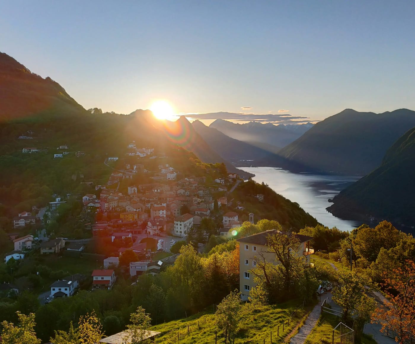
Brè Village
Whether you're hiking, mountain biking, or riding the funicular round-trip, you have to visit Bre village! It's a charming car-free enclave of stone houses, cobblestone streets and steep terraces growing olives, chestnuts, and grapes. There are records of this community going all the way back to 1280!
Views of Brè Village (Photo by Robin Ulrich on Unsplash)
The village has an artist colony vibe with a highlight being the Path of Art (a self-guided trail through the center) where you'll spot over a dozen sculptures, frescoes, and installations dotting alleyways and walls. Brè is tiny and you can explore the whole thing in 30-45 minutes, so don't forget to make time in your itinerary for a quick visit.
We hiked down to the village in 10 minutes and back up in 20. You could also take the funicular to Brè Villaggio funicular stop, then walk for just 5 minutes.
Save this guide, pack your sunscreen, and make Monte Brè the next peak on your Ticino itinerary! If you're looking for an easy lakeside trail to add to your list as well, check out my blog on the Olive Grove Trail. Happy travels!